lunes, 10 de agosto de 2015

Musala (Мусала)

Musala es la montaña más alta de Bulgaria (2925.40m), esta situada en el Parque Nacional de Rila.
El nombre proviene de Mus Allah (la montaña de Dios).

Musala mountain is the highest in Bulgaria (2925.40m), is located in National Rila Park.
The name come from Mus Allah (the Mountain of God).


La mejor forma de ascender es por un sendero desde el resort de esquí Borovets. La otra opción es coger el telecabina hasta Yastrebets (2.369m). Desde Yastrebets empieza el camino hacia el refugio Musala (2.430m), es un camino plano y fácil que pasa por la estación de esqui.

The best way to ascend it is by a footpath from the ski resort of Borovets. The other option is to take the cable car up to Yastrebets (2.369m). From Yastrebets start the path to the Musala refuge (2.430m) is a flat and easy walk that passes through the ski resort.

Refugio Musala. Lago Musalenski ezera.

La ascensión se hace en 2-2:30horas y se pasa por lugares tan encantadores como podemos ver en las fotografías. 

The ascent to the top can be done in 2-2: 30hours and we can enjoy delightful views as we can see into the photographs.

Lago Aleko.

Lago Ledenoto.

Tuvimos un día un poco nublado y no veiamos la cima. El tramo final de ascensión es el que se hace más duro. Hay dos opciones, o subir haciendo zetas o como vemos en la siguiente fotografía, ayudados de una cuerda siguiendo la cresta de la montaña.

We had a slightly cloudy day and we could not see the top. The final leg of ascension is the hardest. There are two options, or go up doing Z or following the ridge of the mountain as shown in the following picture.

Ultimo tramo de la ascensión.

Finalmente llegamos a la cima, pero al ser un día nublado, no pudimos contemplar el paisaje.

Finally we reached the top, but being not a clear day, we could not see the landscape.


Una excursión que valio la pena, muy recomendable. Nosotros la hicimos durante le mes de agosto. Si os ha sido útil nuestra explicación, esperamos que nos contéis vuestra experiencia.

A trip highly recommended. We did this hiking in August. 
If our explanation have been useful, we would like to read a comment from you.

jueves, 5 de septiembre de 2013

Melnik

Habitantes/ Habitants: 208
Municipio/ Municipality: Sandanski
Provincia/ County: Blagoevgrad
Distancia a la capital/ Distance to the capital: 175km


Melnik es la ciudad más pequeña de Bulgaria, aún se la llama ciudad por motivos históricos.
El nombre Melnik viene de la palabra eslava "mel" la cual significa barro blanco, por las pirámides que le rodean. Estas pirámides fueron declaradas monumento natural en 1978.

Melnik is the smallest town in Bulgaria, is called town because of historical reasons.
The name of Melnik comes from the Slavonic word "mel" which means white clay, because of the surrounding sand pyramids. This pyramids were declared a natural landmark in 1978.


Diversos hallazgos muestran la historia de este lugar. Como por ejemplo un puente romano.
Podemos ver también las murallas de la fortaleza de Despot Alexius Slav, gobernador de Melnik cuando se independizo en 1215. 

The finds from the antiquity discovered upon the archaeological diggings testify for its centuries-old history. For example an ancient Roman bridge.
In 1215 Melnik turned into a capital of an independent feudal principality, ruled by Despot Alexius Slav. The ruins of his fortress are preserved to the present days, near the town.


Una de las casas más viejas en los Balcanes es la casa Boyar (declarada monumento arquitectónico en 1965), la cual fue residencia de Despot Alexius Slav. A mediados del siglo XIII fue quemada y más tarde reconstruida.

One of the oldest houses on the Balkan Peninsula is the Boyar’s House (declared an architectural monument in 1965), which was a residence of Despot Alexius Slav. In the middle of the 13th century a part of it was set on fire and destroyed, and during the following centuries it was restored and reconstructed.


Otras dos casas declaradas monumentos arquitectónicos son la casa Kordopulova (el edificio más largo del resurgimiento Nacional Búlgaro  y la casa Pashova (construida en 1815). 
Other two houses which are declared architectural monuments of the Revival are the Kordopulova House (the largest building from the Bulgarian National Revival) and the Pashova House (built in 1815). 


Iglesia St. Nicholas, cerca de Melnik. Solo la pared oeste se conserva y algunos elementos en el interior.
Church Sant Nicholas, near the town of Melnik. Only the west wall is preserved and a few elements of the interior of the church.


Aqui podemos ver Konak, la residencia abandonada del governador turco.
Here is the Konak, the abandoned former residence of the turkish governor.

Melnik es también famoso en Europa entera por su tan preciado vino, hecho desde el 1346. Algo que no te puedes perder!

Melnik also became famous in entire Europe for its good wine, they make it since 1346. Something you can't miss!


Yordan DV & Núria DG

martes, 3 de septiembre de 2013

Stob Pyramids

Stob (el pueblo)/ Stob (the village)


Coordenadas/Coordinates: 42º05'43"N 23º06'16"E
Situación/ Location: South-Western Bulgaria
Distancia a la capital/ Distance to the capital: 68.7Km (Sofia)
Altitud/Altitude: 300-499m del nivel del mar/ above sea level
Provincia/ Province: Kyustendil District
Municipio/ Municipality: Kocherinovo Municipality
Area: 20.323km2
Población/ Population: 716 (2012)

Pueblo situado a los pies de las montañas de Rila y cerca del monasterio de Rila.
Distancia de unos 6km de la ruta europea E79, que conecta eñ pueblo con los pueblos de Dupnitsa, Blagoevgrad y Sofía.
El relieve es medio montañoso y el clima es de tipo continental, caracterizado con inviernos frios y veranos cálidos y secos.
La iglesia del pueblo tiene exclusiva arquitectura St. Prokopiy. Fue construida en 1873 y los valiosos murales e iconos están bien conservados.
Stob es conocido por sus pirámides, un fenómeno natural rocoso.

Village located at the foot of the Rila mountains and not far from the Rila Monastery.
About 6km away is the European route E79, connecting the village to the towns of Dupnitsa, Blagoevgrad and Sofia.
The relief is mid-mountainous and the climate in the region is continental, characterized with mild winters and warm and dry summers. 
The village church with unique architecture St. Prokopiy was buit in 1873 and the valuable murals and icons there are well preserved.
Stob is notable for the Stob Pyramids, a natural rock phenomenon in the vicinity of the village. 


Stob Pyramids: 

Se trata de formaciones de piedra y tierra de 30 a 40m de profundidad que se encuentran a 7km al noreste de la aldea. Los sedimentos son de color naranjoso debido a su ubicación.
Están bajo protección del Estado desde 1964.
Son formaciones rocosas de hasta 12m de altura. Tienen una forma cónica parecida a una seta. Algunas de las columnas están coronadas por piedras planas.
Algunas de las pirámides tienen nombre como Las Torres, Los Pináculos y las Chimeneas Samodiva.
Según una leyenda popular, se dice que las pirámides son invitados de boda petrificados por la belleza de la novia. La población local identifica algunas de las pirámides como el novio, la novia y otros asistentes a la ceremonia.

¡Especialmente hermosas al atardecer!


These are stone and earth formations, 30-40m deep, located 7km to the northeast of the village. The sediments are coloured orange because of their location.

The Pyramids have been under state protection since 1964 as a protected site.
The pyramids are rock formations up 12m high and around 40cm thick at the base. They vary shape from sharp through conical to mushroomlike. Some of the columns are topped by flat stones.
Groups of individual Pyramids have been named The Towers, The Pinnacles and Samodiva Chimeneys.
According to a popular local legend, the pyramids are in fact wedding guests who were petrified because the bride was so beautiful that the best man attempted to kiss her. Based on the legend, the local population has identified some of the pyramids as the best man, the groom, the bride and other attendants of the wedding ceremony.

The pyramids are especially beautiful at sunset or at moonlight!


Yordan DV & Núria DG

sábado, 24 de agosto de 2013

Ruta por refugios en Rila (Rila refugis)

Montaña/ Mountain: Rila
Estación/ Season: Veranos/ Summer
Duración/ Duration: 3 días (2 noches)/ 3 days/ 2 nights

1r DIA/ 1st DAY:
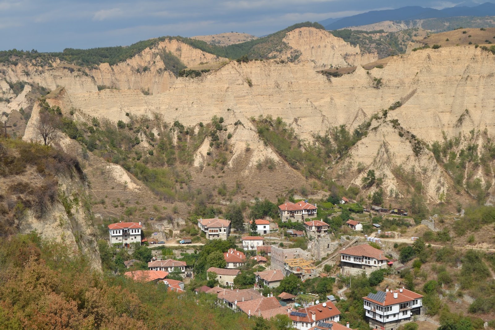
Esta es una de las rutas mas bonitas en las montañas de Rila. Todo empezaba cuando el coche nos dejo en el resort Bodrost. Este, esta a 29Km de Blagoevgrad. Desde allí nos cargamos las mochilas y ascendimos al refugio llamado Makedonia, a 9Km. En 2 horas y media llegábamos  el camino era claro, no tiene perdida. (foto 1 y 2)

This is one of most beautiful transition in Rila mountain. Everything started when the car left us at summer resort Bodrost (Бодрост). The resort is 29 km from Blagoevgrad (Благоевград). From there we took the big bags and we head to rest house Makedonia (Македония) about 9 km. We did the hike for 2 hours 30 min the road was slanting and big and that was advantage (photo 1 and 2).

1. Road to rest house Makedonia(Македония)


2. Road to rest house Makedonia(Македония)

El refugio en el valle llamado Mechi Prohod entre  el pico Malyk Mechi (Малък мечи) y el Golyam Mechi (Голям мечи) cimas de 2166m de altura. Íbamos a pasar la noche allí. Tienen habitaciones con camas y ofrecen comida. Los propietarios son buena gente, acogedores. Por la tarde fuimos a la cima mas cercana para contemplar las vistas, la llamada Malyk Mechi, a 2474m, en 40 minutos estábamos allí (foto 3). Las vistas eran increíbles  se pueden ver tanto las montanas de Pirin como de Rila. Contemplamos durante un rato las vistas y bajamos de nuevo al refugio a cenar.
La noche nos tenia una sorpresa preparada, salimos con una manta a ver las estrellas y solo subir el cielo empezamos a disfrutar de una lluvia de estrellas, impresionante.

We found the rest house"Makedonia" 2166m at the col Мechi Prohod between Malyk Mechi(Малък мечи) peak and Golyam Mechi(Голям мечи) peak. We were going to spend the night there.The house had rooms with beds and it offer food and drinks. The owners were hostile. In the afternoon we went to one of the peaks near. "Malyk Mechi"  peak is at 2474m and you go there for about 40 min (photo 3). We had some amazing views . You can see all Rila and Pirin from the top.We went back and it was almost time to dinner. After we went outside to enjoy the clear sky and the stars. But the stars had a very special plans for the night we saw a lot of starfalls in the sky and some wery realy great. 


 3. Blick of "Golyam Mechi" peak and hut "Makedonia" (Голям мечи връх и хижа Македония)

2o DIA/ 2nd DAY:

Dormimos como troncos ya que estábamos agotados pero debíamos madrugar, nos esperaba un día largo. Las consultas que habíamos hecho nos decían que la ruta por hacer era de 6 horas hasta llegar al refugio Ribni Ezera (Рибни езера), así que nos pusimos en marcha. Nos dirigimos hacia Golyam Mechi, el camino esta marcado y es fácil de seguir, pero empezábamos con una fuerte subida, buena para despertar el cuerpo. A medio ascenso tomamos un respiro y nos concienciamos de lo que nos quedaba, con el miedo de si nos cogía la tormenta que habían anunciado por televisión  Pues bien, desde el lugar donde paramos podíamos ver la cima del Golyam Mechi (2617m) y al otro lado Angelov a 2643m de altitud, nuestros dos siguientes retos.


We slept good and we wake up early. It was time to go for our next destination. One of the best transitions in Rila. We were going to do a 6 hours trip to rest house Ribni ezera(Рибни езера). We head up to Golyam Mechi peak.The path was marked and easy to follow but it was very steep. We were exhausted. We took a break just on the foot of the peak and we saw what we had  ahead of us. There you could see standing Golyam mechi 2617m and  Angelov(Ангелов) peak 2643 m. The path is going at the edge of the two peaks and you see amazing views from both sides. We head to Angelov peak and soon we were on the top.Our second peak in 1 hour.


"Angelov" peak 2643m(Ангелов връх) in the distance


El camino continúa en dirección a Uzunitsa (Узуница), siguiente cima a 2.606 m. Como ya estábamos mas o menos a esa altura solo tuvimos que bajar un poco y subir. Desde allí teníamos una clara visión de nuestro próximo objetivo (Aladja Slap). 

The path continue to the next high peak Uzunitsa(Узуница) 2606 m . We didn't had to climb because they were on the same level with peak Angelov even going down a bit. From there we had a clear view of our next challenge. The way was going down through bushes and rocks and soon after we were on the foot of a next peak. We were really down of the top. We had long way going up to this one.

Blick from peak Angelov to peak "Uzunitsa" 2606m(връх Узинитца) аnd in the distance pеак "Aladja Slap"(Аладжа Слап)


blick of the foot of peak "Aladja Slap" to peak "Uzunitsa"

peak Aladja slap 2684m( връх Аладжа Слап)

El pico Aladja Slap (Аладжа слап) estaba a 2684m, el más alto hasta el momento. Necesitamos casi una hora para subir y necesitamos algún que otro descanso. En el lado norte no había vegetación.

The peak was Aladja Slap(Аладжа слап) 2684m the highest so far. We needed almost an hour to go up and we had many breaks but finally we went up. On the other side  there was no vegetation. It was the north side.


blick of Aladja Slap 2685m north side


No había tiempo para descansar, temíamos la lluvia. El camino era muy pedregoso pero pronto estábamos a los pies del pico Cherna polyana 2716m. Había un poco de desesperación entre los del grupo, sera esta la ultima cima o aun no? nos preguntábamos. A los pies de este pico, subimos unos 400m, no había nada de vegetación.


There was no time to rest we head down on a rocky path and soon after we were on the foot of peak Cherna polyana 2716m. I saw some desperation our group it was not possible to climb onther and higher than the last one but we had no choise. We arrived at the foot and we had to climb 400 m up. The top had no vegetation only rock.
 
peak "Cherna Polyana" 2716m(Връх Черна поляна)


Desde arriba teníamos unas vistas increíbles. Teníamos una imagen perfecta de Los lagos Karaalanishkite (Kарааланишките) y Sinioto (Синъото). La cima era increíble, estuvimos allí un rato y hicimos algunas fotografías. 

On the top we found amazing views. There was a perfect shot of the Sinioto(Синъото) lake and The Karaalanishkite(Kарааланишките) lakes. The peak was amazing we stayed there and we took many photos but it was time to go. We were not even near to our destination.

Sinioto lake(Синьото езеро)

Blick from peak" Cherna Polyana"

Nos dirigimos hacia la cima Pavlev (Павлев) a 2.667 m, nuestro ultimo pico por conquistar. Fue el más extraño de todos. La parte superior tenía un cresta rocosa por donde se podía andar, es peligroso, pero también uno de los mejores tramos desde mi punto de vista. Hay un alambre de seguridad. 


We head to Pavlev(Павлев)peak 2667 m our last top to conquer. IT was the strangest of all. The top had a rocky comb that you can pass. ITs very dangerous but also very beatiful. To go down from the top there is a wire to hold otherwise you can fall easily and injure yourself.


peak Pavlev 2667m(Павлев връх)
Al fin vimos el refugio desde lo alto de las montanas, se encontraba entre medio de dos lagos. Creíamos que en 20 minutos llegábamos pero no fue así, tuvimos que andar un poco mas. 

After the last challenge we saw the rest house between two beatiful lakes. The house was down in the valley and we thought we will be there in 20 min but we had to walk a bit more.


"Ribni" lakes and between them rest house "Ribni ezera"

Rodeamos la cima Kanarata (Канарата) 2.691 m, veíamos un valle con un lago llamado "Kanarskoto". Tuvimos que seguir hasta encontrar nuestro valle, cuando lo encontramos, en 20 minutos descendimos y llegamos a nuestro destino, nos hicieron un buen plato de col con carne, plato típico de la zona. 

We did a round of peak Kanarata(Канарата)2691 m and we saw the valley but for our dissapointment was not ours. The valey was the same as of the "Ribni" lakes but this one had one other lake"Kanarskoto". We had to cross the valley and go to the next where was our objective. Finally we saw it in maybe 20 min we went down. We were exhausted and we sit to eat and drink.

lake"Kanarskoto"(Канарското езеро)
3r DIA/ 3rd DAY:

El tercer día en principio teníamos que bajar hasta donde empieza la carretera del monasterio de Rila (2 horas) pero tuvimos algún problemilla técnico. Ningún móvil tenia cobertura y quien nos tenia que venir a buscar no tenia señales nuestras así que decidimos seguir bajando hasta tener señal. Acabamos andando hasta el Monasterio de Rila, unas 4 horas en vez de las 2 horas que creíamos.

The 3rd day, we thought on going down to the road and a car had to come to take us, that had to be 2 hours but we had some technical problem. Any mobile had signal to call and noone came to take us so we walked down throw the road direction Rila Monastery. Fianlly, in spite of teh 2 hours it took us 4 hours until Rila Monastery where the car came to take us.

Este fue nuestro viaje de: 2 refugios, 7 lagos, 7 cimas y una lluvia de estrellas.

That was our trip of: 2 refugis, 7 lakes, 7 peaks and starfalls!   


Yordan DV & Núria DG

jueves, 22 de agosto de 2013

Monasterio de Rila y la Capilla de San Juan

Rila Monastery and the Chapel of San Juan de Rila


Este monasterio fue fundado en el siglo X por San Juan de Rila (Sveti Ivan Rilski), un eremita de la Iglesia Ortodoxa. Su pequeña casa en medio del bosque y su tumba se convirtieron con el tiempo en lugares sagrados, donde se creó el monasterio, uno de los ejemplos mas impresionantes de la arquitectura del resurgimiento nacional búlgaro (sXVIII y XIX).
Fue destruido por un incendio el 1833 pero fue reconstruido gracias a la aportación de búlgaros adinerados entre el 1834 y el 1862.
El monasterio esta protegido por un muro de 20m del altura como si de una fortaleza se tratara.
Fue declarado Patrimonio de la Humanidad por la Unesco en 1983.

This monastery was founded in the tenth century by Saint John of Rila (Sveti Ivan Rilski), a hermit of the Orthodox Church. His little house in the forest and his tomb eventually became sacred places where the monastery was established, one of the most impressive examples of Bulgarian National Revival architecture (sXVIII and XIX).
It was destroyed by fire on 1833 but was rebuilt thanks to the contribution of wealthy Bulgarians between 1834 and 1862.
The monastery is protected by a 20m high wall as if it were a fortress.
It was declared Word Heritage Site by Unesco in 1983.


Siguiendo la carretera, a pocos metros encontramos la Capilla de San Juan de Rila y la cueva donde paso parte de su vida. Si rodeamos la capilla, encontramos una cueva. Se dice que si puedes pasar por la estrecha apertura eres puro de corazón.
El camino es rocoso y conviene ir con un calzado adecuado, aunque puedes encontrar gente con tacones. Si sigues unos metros mas te encuentras una fuente donde la gente deja sus deseos en papelitos entre rocas.

Following the road that took us to the Monastery, we find the Chapel of St. John of Rila and the cave where he spent most of his life. If we surround the chapel, we find the cave. It is said that if you can go through the little hole in the rocks you have a pure heart.
The road is rocky and you should go with proper shoes, but you can find people with heels. If you follow a few yards you find a source where people leave their wishes on slips between rocks.


Si seguimos subiendo la carretera, tanto en coche como andando (andando se puede hacer entre el bosque, hay un camino señalizado , encontramos una área de picnic (donde podemos hacer fuego en las zonas marcadas y acampar), bares, hostales y muchas rutas para senderistas. El río Rilsk nos sigue a todas partes en nuestro recorrido.

If you continue up the road by car or walking (walk can be made between the forest, there is a path signposted), we found a picnic area (where we can make fire in the marked areas and camping), bars, hostels and many routes for walkers. The river Rilski is next to us in all the way.

Todo esto se encuentra en las montanas de Rila.

All that you can find in the mountain of Rila.


Yordan DV & Nuria DG